Insitu Geo-Engineering
OUR SERVICES
Insitu Geo-Engineering specializes in geological and geophysical aspects for the engineering industry. Using advanced technologies, we accurately survey sites for infrastructures, construction, and environmental goals. Through innovation and continuous improvement, we aim to lead in the field of engineering geology, while making an important contribution to construction and development efforts.
Seismic Surveys
Measurement of compressional wave (Vp) and shear wave (Vs) velocities using seismic refraction, seismic reflection, and downhole testing. Determination of shear-wave velocity profiles (Vs30) through surface-wave methods (MASW, ReMi, ESAC, etc.), and H/V spectral ratio surveys for site resonance frequency (f₀) estimation and seismic hazard assessment. These services support site response analysis and earthquake-resistant design in accordance with Israeli standards

Vibration Monitoring
Continuous monitoring and recording of vibrations and ground motions in structures and soil adjacent to excavation, blasting, or heavy construction activities. The collected data is used to protect nearby. structures and ensure compliance with the requirements of DIN 4150-3

GPR Void Detection
Detection and mapping of underground voids, subsidence, and sinkholes beneath roads, construction sites, and development areas, as well as the identification of buried archaeological features using Ground Penetrating Radar (GPR). The survey provides a fast and accurate assessment of subsurface conditions without disturbing existing infrastructure, enabling informed decision-making before and during construction. Survey results are supported by geological interpretation and, where required, verified through exploratory drilling.

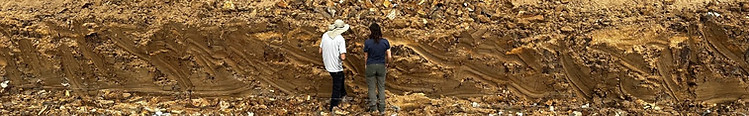
Geological surveys on land, offshore, and in coastal environments, including the identification and mapping of active faults in accordance with Israeli Standard 413 (SI 413), documentation and quantification of landslides and slope failures, geotechnical investigations, and non-destructive surveys supported by UAV (drone) mapping for detailed surface documentation and characterization.
Engineering Geology & Geological Mapping
Preparation of historical land-use assessments and environmental documentation for planning and permitting, in accordance with the requirements of the Israeli Ministry of Environmental Protection. Services include the preparation of environmental reports, technical documentation, and waste management plans to support building permits, statutory planning schemes (Master Plans), and compliance with regulatory requirements.
